
Updated
On this page
For a country the wider world still pictures as mountains and cities, Colombia holds a surprising amount of coast, and two very different oceans at that. To the north, the Caribbean laps warm and turquoise against jungle-backed coves, walled colonial cities, and a scatter of islands where the water shades through so many blues that locals gave it its own name. To the west, the Pacific breaks grey and wild against black sand and dense rainforest, a coast so remote that most of it has no roads at all and humpback whales calve within sight of the beach.
That contrast is the whole point. The Caribbean side is where you go for easy sun, snorkeling, and a hammock strung between palms; the Pacific is where you trade comfort for something rawer and far less traveled. This guide walks the coastline stretch by stretch, from Tayrona’s famous coves to the far islands and the edge-of-the-map villages of Chocó, with the practical detail you need to choose well and plan around the seasons.
Tayrona National Park
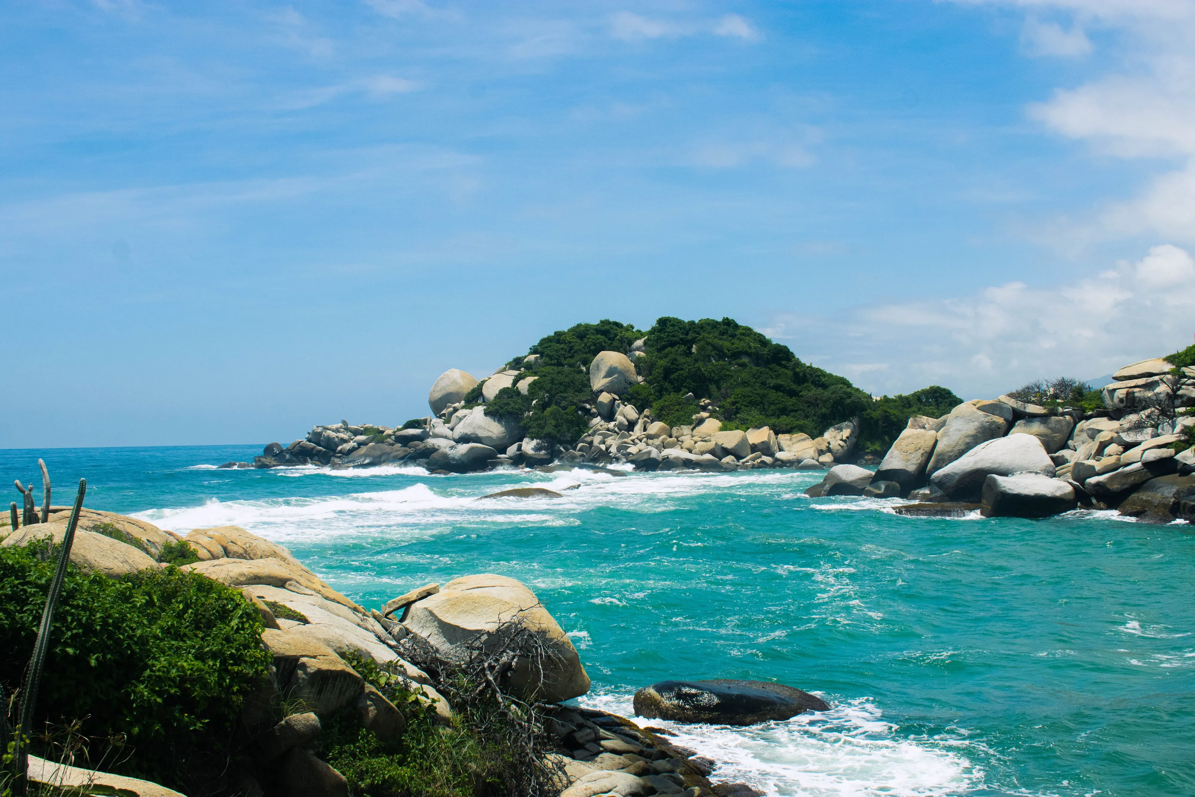
If Colombia has one signature beach, it is inside Parque Nacional Natural Tayrona, an hour east of Santa Marta on the Caribbean coast. Here the Sierra Nevada de Santa Marta, the world’s highest coastal mountain range, tumbles straight into the sea, and the result is a run of golden coves framed by boulders, coconut palms, and thick jungle where you might hear howler monkeys before breakfast. The best-known beaches, Cabo San Juan del Guía and the quieter La Piscina, sit an hour or two on foot from the main Zaino entrance along a shaded forest trail.
Tayrona is a protected reserve, not a resort, and it comes with rules worth knowing before you go. Foreign non-resident visitors pay an entrance fee that shifts with the season, currently around COP 87,000 (about USD 27) in high season and COP 73,500 (about USD 23) the rest of the year, and every ticket includes mandatory assistance insurance. Fees are set by Parques Nacionales and change periodically, so confirm the current rate on the official channel before you travel. Not all beaches are safe for swimming: strong currents and undertow have caused drownings at exposed stretches like Arrecifes, so heed the posted warnings and swim only where it is permitted.
The park also closes completely several times a year so the land can rest and the Indigenous peoples of the Sierra Nevada can carry out their spiritual ceremonies. For 2026 the scheduled rest periods are February 1 to 15, June 1 to 15, and October 19 to November 2, when every entrance and facility is shut. Dates move slightly year to year and additional closures can be announced at short notice, so check before you build a trip around it.
Beyond that routine schedule, Tayrona’s access has been genuinely unsettled this year. Colombia’s national parks authority (Parques Nacionales) closed the park entirely from February 17 to March 5, 2026, citing threats against park staff amid a territorial conflict between armed groups operating in the area. In mid-June 2026, the U.S. Embassy in Bogotá issued a security advisory about armed conflict affecting roads near the park. As of early July 2026, Parques Nacionales lists Tayrona as fully reopened with all sectors operating, but the situation has shifted quickly more than once this year. Check the official Parques Nacionales site and your own embassy’s current travel advisory before you build a trip around Tayrona, not just before you arrive.
You can visit Tayrona as a long day trip, but staying a night, in the campgrounds, hammocks, or eco-cabins inside the park, lets you have the coves to yourself once the day crowds thin out.
The Rosario Islands
An hour by boat from Cartagena, the Islas del Rosario are the easiest island escape on the Colombian Caribbean. This archipelago of coral islands and cays sits inside a national marine park, and the draw is simple: clear, warm water over reef, good snorkeling, and white sand a world away from the city’s colonial bustle. For many visitors it is a day trip, a fast launch out from Cartagena’s tourist port, a few hours on a beach club’s sun loungers, lunch, and back by late afternoon.
It rewards a slower approach. Staying overnight at one of the small eco-hotels on islands like Isla Grande or Isla Barú lets you snorkel before the day boats arrive and watch the bioluminescent plankton light up the mangrove lagoons after dark. Boat transfers, park fees, and the various island day passes are all priced separately and change often, so book through a reputable operator and confirm exactly what is included before you pay. Because the Rosarios pair so naturally with a few days in the walled city, most people fold them into a wider Cartagena trip; our Cartagena travel guide covers where to stay and how to get out to the islands.
San Andrés and Providencia
Far out in the Caribbean, closer to Nicaragua than to the Colombian mainland, the archipelago of San Andrés, Providencia, and Santa Catalina floats in water so vividly banded that it is known as the mar de siete colores, the sea of seven colors. This is Colombia’s slice of the western Caribbean, a place with its own Raizal culture, Creole English, and a lilting island rhythm quite unlike the mainland coast. Reaching it means flying: San Andrés has direct domestic flights from Bogotá, Medellín, and Cartagena, and fares swing widely with the season, so it pays to book ahead and travel light, since baggage rules on the route are strict.
San Andrés, the larger and busier island, is ringed by a barrier reef and geared toward diving, snorkeling, and beach days, with the postcard cays of Johnny Cay and the aquarium-clear shallows of the Haynes Cay lagoon just offshore. Quieter Providencia, a short onward flight or a sometimes rough catamaran crossing away, is the one many travelers fall for: greener, sleepier, and fringed by one of the longest barrier reefs in the Americas. Providencia was badly hit by Hurricane Iota in 2020 and has worked hard to rebuild, and a visit today directly supports that recovery. Note that all visitors to the archipelago pay a tourist card fee on arrival, so factor that into your budget.
Palomino and the Guajira Coast
East of Tayrona, the coast opens out and the pace drops further. Palomino is the backpacker darling of this stretch: a long, wild beach where the Sierra Nevada’s rivers run down to the sea, a dirt main street of hostels and juice bars, and the singular local pastime of tubing down the Río Palomino from the foothills to the shore. The beach itself has a powerful shore break and is better for sunset walks than swimming, but the village makes an easy, low-key base between Tayrona and the desert beyond.
Push on and the land turns to the arid, windswept Guajira Peninsula, Colombia’s northernmost point and the homeland of the Wayuu people. This is a different kind of coast altogether: red desert running straight into the sea, roaming goats, and the remote dunes of Cabo de la Vela and Punta Gallinas, the tip of the South American continent. There is little infrastructure out here, and reaching the far points means a long 4x4 journey with a local operator, usually as a two or three day tour arranged from Riohacha or Palomino. Go with a Wayuu-led or community-based outfit where you can, carry cash and water, and treat the region’s remoteness and its cultural sensitivities with respect.
The Pacific Coast
Colombia’s other coastline could hardly be more different. The department of Chocó, on the Pacific, is one of the wettest and most biodiverse places on earth: a green wall of rainforest meeting black-sand beaches, threaded by rivers rather than roads. There is no coastal highway here. You reach the main hubs, Nuquí and Bahía Solano, by small plane from Medellín or Quibdó, landing on short jungle airstrips, and then travel on by boat to the scattered eco-lodges along the shore.
What draws travelers to trade the comfort of the Caribbean for all this effort is the raw wildness of it, and above all the whales. Every year humpback whales migrate thousands of miles from the Antarctic to breed and give birth in these warm waters, and they are close enough to watch from small boats and sometimes from the beach itself. The season runs roughly July to October, with August and September the peak months, and the Ensenada de Utría National Park between Nuquí and Bahía Solano is one of the finest places in the world to see mothers with their calves. Beyond the whales, the Pacific offers empty surf breaks, jungle waterfalls, sea turtle nesting, and a genuine sense of the edge of the map. Come prepared for rain in any season, book through the established lodges, and build slack into your plans, since flights and boats bend to the weather here.
Choosing a Coast and When to Go
The two coasts ask for different trips and, to some extent, different seasons.
For the Caribbean, the driest and most reliable weather runs from December to April, which is also the busiest and priciest window, especially over the Christmas, New Year, and Easter holidays, when Cartagena, Tayrona, and San Andrés fill up and rates climb. The shoulder months on either side can be quieter and better value, with the trade-off of occasional rain. Remember Tayrona’s annual closures when timing a coastal trip, and book island stays and popular eco-lodges well ahead in high season.
For the Pacific, the calendar bends around the whales. July to October is the reason most travelers come, and August and September are the peak, so lodges and flights should be booked months in advance for those dates. The region is rainy year-round, so waterproof everything and expect changeable conditions whenever you go. As a rough rule: choose the Caribbean for easy sun, snorkeling, and colonial-city culture, and the Pacific for wildlife, solitude, and a wilder, more adventurous trip. Whichever coast you pick, the practical basics in our Colombia safety guide are worth a read before you set out, and if you would rather have the logistics handled, a guided Colombia tour can stitch the coastlines into a wider route.